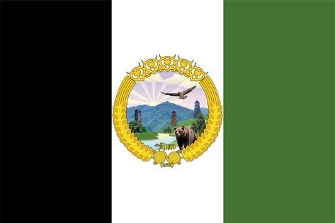
Цунтинский район — высокогорная земля в бассейне реки Метлуды, на границе с Грузией. Здесь рядом стоят леса, луга, альпийские луга и каменистые склоны Богосского хребта.The Tsuntinsky District is a highland land in the basin of the Metluda river, on the border with Georgia. Forests, meadows, alpine pastures and the rocky slopes of the Bogos ridge lie side by side here.
Земля и горыLand and mountains
- Площадь района — 963,57 км² (без Бежтинского участка). Это историческая земля расселения дидойцев (цезов) — Дидоэтия.The area of the district is 963.57 km² (without the Bezhtinsky part). It is the historic land of the Didos (Tsets) — Didoetia.
- С запада и юго-запада район граничит с Грузией: непроходимые горы отделяют его от Тушетии, а от долины Алазани — Главный Кавказский хребет с Кодорским перевалом (2365 м).To the west and south-west the district borders Georgia: impassable mountains separate it from Tusheti, and the Main Caucasus Range with the Kodor Pass (2365 m) separates it from the Alazani valley.
- На востоке район отделён Богосским хребтом от бассейна Аварского Койсу. Длина хребта — около 72 км, высшая точка — гора Адалла-Шухгельмеэр (4151 м); на Богосе одиннадцать вершин-четырёхтысячников.To the east the district is separated by the Bogos ridge from the basin of the Avar Koysu. The ridge is about 72 km long; its highest peak is Adalla-Shukhgelmeer (4151 m), with eleven four-thousand-metre summits.
- Вершины и склоны гор покрыты тучными лугами, а ближе к течению главных потоков растут дровяные и строевые леса. Тучный чернозём и обилие влаги дают здесь урожаи сам 15–20.The summits and slopes are covered with rich meadows, and closer to the main streams there are fuel and timber forests. The fertile black soil and the abundance of moisture give harvests of 15–20.
Реки и озёраRivers and lakes
- Главная река — Метлуда (Китлярта, Метлюта): длина 45 км, площадь водосборного бассейна 836 км². Она впадает в Андийское Койсу в 108 км по правому берегу, а Андийское Койсу несёт воду в Сулак и Каспийское море.The main river is Metluda (Kitlyarta, Metlyuta): 45 km long, with a catchment basin of 836 km². It joins the Andi Koysu 108 km along its right bank; the Andi Koysu flows into the Sulak and the Caspian Sea.
- Притоки Метлуды — Шаитли, Кидеро, Сабакунисхеви, Китлярта и другие. Вся эта система рек образует Дидойскую котловину.The tributaries of Metluda are Shaitli, Kidero, Sabakunishevi, Kitlyarta and others. This whole river system forms the Dido valley.
- На Богосском хребте — 27 озёр и ледники общей площадью около 20 км². Горные потоки и озёрцо Хупро славятся форелью.The Bogos ridge holds 27 lakes and glaciers with a total area of about 20 km². The mountain streams and the small lake Khupro are famous for trout.
- Среди памятников природы — многоярусный водопад Ажучи у села Тинди, сосны, растущие на большом речном камне у Хуштады и Тинди, берёза с восьмиметровым обхватом у хутора Квачах и земляной «крокодил» у Кванады.Among the natural landmarks are the multi-tiered Azhuchi waterfall near Tindi, pines growing on a large river boulder near Khushkada and Tindi, a birch with an eight-metre girth near the Kvachakh farmstead, and the earthen “crocodile” near Kvanada.
Животный мирWildlife
- Животный мир Богосского хребта представлен ценными видами: медведь, серна, дагестанский тур, улар, куница.The wildlife of the Bogos ridge includes valuable species: bear, chamois, Dagestan tur, rock ptarmigan and marten.
- Леса и луга изобилуют дичью, в лесах много ягодных кустарников и грибов.Forests and meadows abound with game; the woods grow plenty of berry bushes and mushrooms.
- На горных лугах альпийской полосы находят обильный корм и местные, и чужие стада — так дидойцы получают известный промысел сабалахо.The alpine pastures provide abundant forage for local and passing herds — this is how the Didos have long practised the sabalakho grazing trade.
Природа и человекNature and people
- Природа Дидо не так сурова, как кажется на первый взгляд: голых скал здесь почти нет, а вершины и склоны одеты лугами, у главных потоков — лесами.The nature of Dido is not as harsh as it seems at first: bare cliffs are almost absent here, and summits and slopes are clothed in meadows, with forests along the main streams.
- Суровые и долгие зимы разобщают сёла с остальным миром более чем на полгода — и потому так важны заготовки, сенокосы и надёжные дороги.Harsh, long winters cut the villages off from the rest of the world for more than half a year — which is why haymaking, winter stores and reliable roads matter so much.
- На Богосском хребте действуют Бежтинский и Кособско-Келебский заказники — territory where wildlife and alpine plants are protected.The Bezhtinsky and Kosobsko-Kelebsky sanctuaries are established on the Bogos ridge — territories where wildlife and alpine plants are protected.
«Перевалившись через Кодор, поражаешься сурачным колоритом глубоких и тесных ущелий Дидо, на дне которых шумят быстрые потоки. Но по мере ослабления первых тяжёлых впечатлений приходишь к заключению, что здешняя природа далеко не так скучна и сурова, как кажется на первый взгляд».“Crossing the Kodor, one is struck by the sombre colouring of the deep, narrow gorges of Dido, at whose bottom the swift streams roar. But as the first heavy impressions fade, one comes to the conclusion that the nature here is by no means as scanty and severe as it seems at first glance.”
Н. И. Воронов, 1868N. I. Voronov, 1868
Смотрите такжеSee also
- 🏘️ Сёла — 59 сёл района: Шаури, Кидеро, Мокок, Асах и другие, с фотографиями и историей🏘️ Villages — 59 villages of the district: Shauri, Kidero, Mokok, Asakh and others, with photos and history
- 📷 Галерея — фотографии сёл, гор и людей📷 Gallery — pictures of villages, mountains and people
- 📖 Истории Башни — историческая справка о дидойцах📖 Stories — the historical reference on the Didos
Описание подготовлено автономией НКА «Дидойцы». Цитата приводится по книге Н. И. Воронова «Кавказ в описаниях» (1868). Раздел будет пополняться фотографиями и материалами жителей.The description was prepared by the Dido NCA. The quotation is taken from N. I. Voronov’s “The Caucasus in Descriptions” (1868). This section will be expanded with photographs and materials from residents.